


Meet OldNYC, the app that shows you the city's past in real time
With the rapid pace of change and development that happens every day in NYC, history has a way of getting literally paved right over. But thanks to a new app, it's easier than ever to see how the city looked long before you arrived.
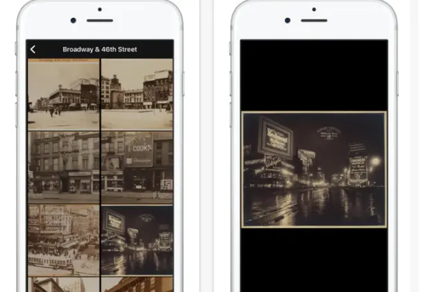
Aptly titled OldNYC, the app takes historic photos from the New York Public Library's formidable digitable collection and organizes them in an easy-to-navigate format, so you can pull up a map and see what used to be on the block where you're currently standing. For instance, check out these snaps of St. Marks Place in the 1930s:

Or these shots of the Upper East Side before white brick buildings ever entered the picture:
OldNYC creator Orian Breaux told Bushwick Daily that in the long term, the goal for the app is to allow users to "augment reality by pointing their phones at any location to see 'what was there,' like a historical x-ray vision for the city." Currently, it's just populated with photos from the library's collection (which spans 1870 through 1970), and while it's well filled out, doesn't have options for every area (and era) of the city quite yet.
For now though, it's got a pretty impressive compendium of photos, and is a nice way to get a little something extra out of your next long city walk.
You Might Also Like


