


Map: Find out if you live near a toxic site in North Brooklyn
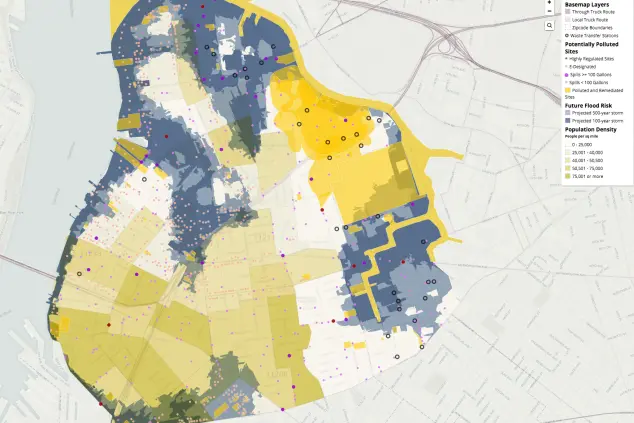
In the rush to develop areas like Gowanus and Greenpoint landing, it's easy for developers to forget (or conveniently ignore) the areas' long-standing histories of toxic waste and other dangerous pollutants. That in mind, a new map aims to keep consumers informed about potential hazards in their north Brooklyn neighborhoods, and how to protect their own health.
As reported by DNAinfo, local advocacy group Neighbors Allied For Good Growth created the map using data from the Environmental Protection Agency and other sources to look at factors like waste transfer sites, superfund sites, areas where "historic pollution" is being monitored, and other data points like truck routes, asthma rates, and future flood risk. (You can play around with the detailed map here.)
NAGG describes the project as "an interactive map of toxic 'hot spots,'" and organizer Allison Currier told DNAinfo, "People need to understand where they live and how to protect themselves [...] [This area] was never really meant to be residential. People don't realize that where they're living can be harmful to their health."
The idea is to spur local residents to get involved in local politics and demand better conditions, for instance, by reporting ongoing construction conditions that are hazardous to the health of locals.
This particular map only covers Williamsburg and Greenpoint, but if you'd like to investigate further, PropertyShark has previously mapped out toxic sites all over the city.
You Might Also Like


